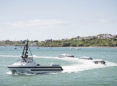
UK Hydrographic Office contributes to autonomous navigation study
The UK Hydrographic Office (UKHO) has contributed to a new UK government-funded study on navigational requirements for autonomous maritime vessels.
The UKHO worked together with partner organisations L3 ASV and the Maritime and Coastguard Agency to identify the future data requirements for autonomous shipping and explore how navigational and wider geospatial data can be used to enable the safe navigation of smart and unmanned autonomous vessels.
The study, funded by the Department for Transport’s Transport Technology Research Innovation Grant (T-TRIG), started by exploring the characteristics of current navigational data and charts in terms of what they comprise, their structure and how they are updated. It then examined how these data sets could be repurposed to develop a prototype “Smart Chart” system, incorporating data such as radio signals, regulations, tides, and foundation navigational data that can be interpreted by a computer without the use of an onboard crew.
The UKHO believes findings from the study will help to support the development of navigational requirements for autonomous vessels and will look to use its expertise in marine geospatial data to help further develop this area of shipping.