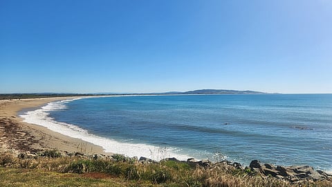
New Zealand's Otago Regional Council (ORC) will conduct a seabed survey in July to determine the current dimensions of the Clutha River’s coastal “sand wedge” deposit in Molyneux Bay, South Otago.
The survey results will be compared to a similar survey from 2013 to map any changes in the sand deposit.
Julion Wright, an ORC Natural Hazards Analyst, said the sand wedge is an, "important part of the South Otago sediment system". He added that, “The results of this will have future implications for coastal and river management in South Otago.”
The offshore survey will be conducted by Geomatics NZ using a single-beam echo sounder mounted on the University of Otago’s 6.5-metre research vessel, RV Tūhura. The vessel is expected to travel about 180 kilometres over a week, weather permitting. This work will be combined with onshore land surveying and data from an earlier airborne LIDAR survey.
Once the survey is complete, the raw data will be processed and analysed to interpret what changes may have occurred since 2013. The results will then be made publicly available.

