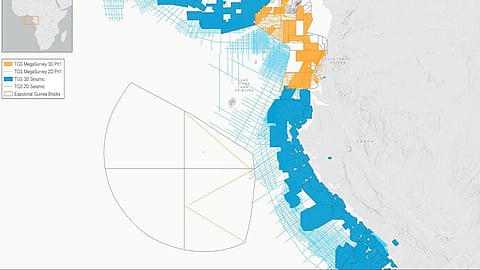
Norwegian subsea data company TGS has signed an agreement with the Ministry of Hydrocarbon and Mining Development of the Republic of Equatorial Guinea to create a large-scale regional seismic dataset.
Under the agreement, the first phase involves the reprocessing of approximately 27,273 kilometres of two-dimensional seismic data and around 35,000 square kilometres of three-dimensional seismic data.
According to a statement from the company, this first phase is expected to be completed by the third quarter of 2026.
This initial project forms part of a broader plan to build a harmonised dataset that will eventually encompass about 46,343 kilometres of two-dimensional data and more than 59,000 square kilometres of three-dimensional data.
David Hajovsky, Executive Vice President of Multi-Client at TGS, explained that the programme will apply imaging technology to address subsurface challenges and support exploration risk reduction in the Rio del Rey and Rio Muni basins.
The dataset is intended to provide a basin-wide regional screening tool to help identify and rank prospects, Hajovsky added.

